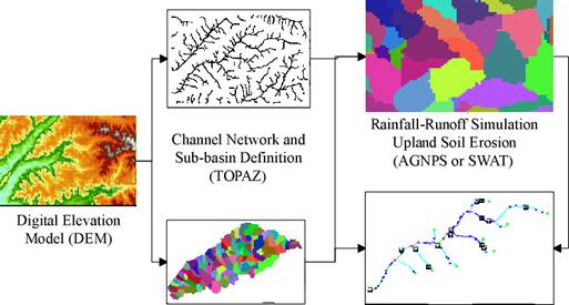
The CCHE1D channel network model is designed to integrate with watershed models such as AGNPS or SWAT. The integrated modeling system can be used as a tool to evaluate the effectiveness of erosion control and channel remediation measures on sediment yield, and to study the influence of land use changes and agricultural management practices on erosion and sedimentation in channels and upland areas. The landscape analysis tool TOPAZ is used to define the subwatersheds and extract the channel network from the digital elevation model (DEM) for watershed and channel modeling. A graphical user interface has been developed based on ArcView GIS to handle data preparation, simulation and post-processing of modeling results.
Procedures for the Integration of CCHE1D Channel Network Model with Watershed Model AGNPS or SWAT
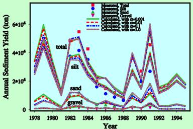
Measured and Simulated Annual Sediment Yieldsin Goodwin Creek Watershed (1982-1991)